By: Sam Doak
January 10 2024


 A map of the Gaza Strip and Israel. (Source: Wikimedia commons.)
Since October 7, the focus of fact-checkers, news outlets, and researchers has been squarely set on the violence unfolding across the Gaza Strip and Israel. While the skills required to monitor, research, and investigate conflicts from afar are numerous, the ability to accurately geolocate images and footage is vital to any individual or organization seeking to verify content from the field.
While the ability to geolocate has been increasingly valued by organizations in recent years, attempts to apply such skills to coverage of events in Gaza and Israel have highlighted how a challenge it can be.
The reasons that geolocation is particularly difficult in this region are numerous. Due to concerns relating to Israeli security, American companies were – until 2020 – under tight legal restrictions regarding the quality of satellite imagery showing Israel and Gaza they were allowed to make publicly available. While these obligations have been lifted for some time, leading providers such as Google and Apple have since failed to update their imagery to a quality comparable with that depicting other regions. Services such as street view are likewise not available.
Paid services, such as those offered by Planet Labs, could constitute a useful alternative to open platforms like Google Maps, but providers have chosen to withhold high-resolution imagery relating to Gaza on occasion in recent months.
While the lack of high-quality satellite imagery alone is enough to complicate geolocation efforts, the devastation caused by aerial warfare in densely urbanized areas presents a compounding difficulty. Put simply, areas across much of Gaza are likely to have changed significantly from the time at which they were photographed by satellite, due to targeting by Israeli forces.
Highlighting this reality, Chris Osieck, a researcher who has worked extensively on geolocating footage from Gaza and the surrounding region, told Logically Facts “The bombardments have caused the Gaza Strip to even become unrecognizable, which sometimes asks you to look at touring and walking videos from travel bloggers on YouTube to see how things were before.”
While these issues may seem daunting, there are methods and resources that can help with geolocation in areas with poor-quality satellite imagery, and lack of street view. While not all are applicable to Gaza, they can greatly expand the capabilities of those seeking to geolocate media recorded in such environments.
Frequently, those seeking to geolocate an image or video may know – or suspect – it was recorded within a specific area. In cases such as these, image libraries such as Getty Images and Reuters Pictures are valuable resources. Searching the name of the location will often reveal high-quality photographs that can be matched with footage, and provide additional visual information.
These resources are particularly useful in contexts that attract a high level of media coverage, as they raise the likelihood that a photographer will be on the ground.
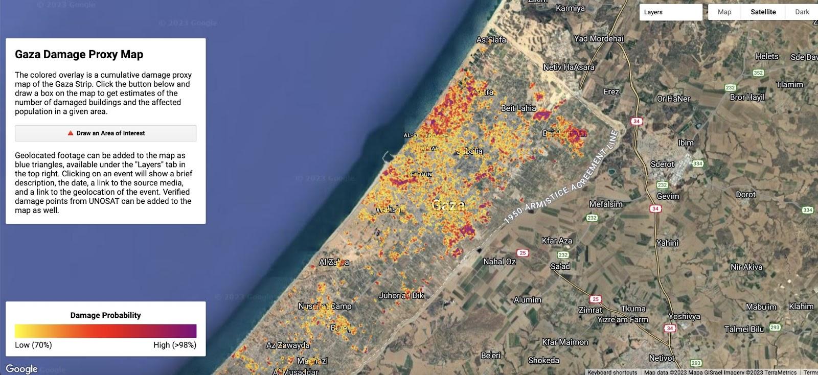
Released by Ollie Ballinger, a Lecturer at UCL’s Centre for Advanced Spatial Analysis, the Gaza Damage Proxy Map is a tool that indicates the likelihood that locations have changed significantly since October 10, 2023. It compares recent Synthetic Aperture Radar (SAR) imagery with data captured on October 10. As significant damage to a structure will change how it reflects microwaves, these results provide a valuable indicator in areas inaccessible to journalists and researchers.
In the context of geolocation, this can help narrow down search areas. If a scene in a video or image shows heavily damaged buildings or other significant destruction, there is a likelihood it will be an area highlighted by the tool. Handily, the tool allows users to easily check if footage has been geolocated to a highlighted location, reducing the risk of time wastage.
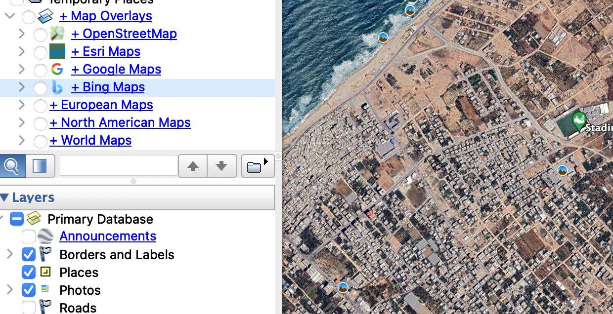
Every map, on and offline, will contain a varying level of detail. With satellite maps in particular different providers will often have imagery that varies in quality and recency. A way to address this difficulty is to download map overlays on Google Earth. This allows users to quickly toggle between different maps of the same location in a manner much easier than switching between platforms.
This can be particularly useful in Gaza, where online maps and satellite imagery can be of low quality, and contain sparse levels of information concerning a given area.
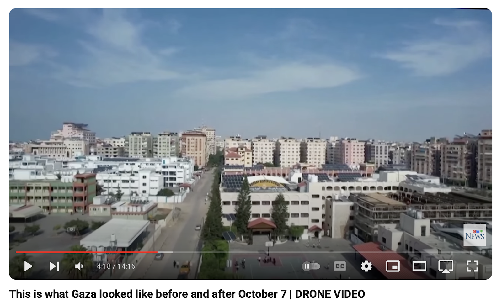
Often areas will have been filmed from above by aircraft or drone. Usually easily searchable on platforms such as YouTube, these videos can offer a highly detailed birds-eye view of an area and will make visible details that are unclear on satellite maps.
The existence of relevant footage of this nature is particularly likely when it concerns urban environments, culturally significant locations, and visually striking areas.
As events have unfolded in Gaza, journalists and researchers have increasingly relied upon publicly available livestreams to follow developments on the ground. Made available by a range of individuals and organizations, these can provide useful visual information for those trying to trace the origin of images and footage once a search area has been narrowed down.
To find a range of resources, one can simply search on a platform such as YouTube, or check more specialized sites such as Windy. Handily, YouTube archives old livestreams, allowing users to view locations streamed previously.
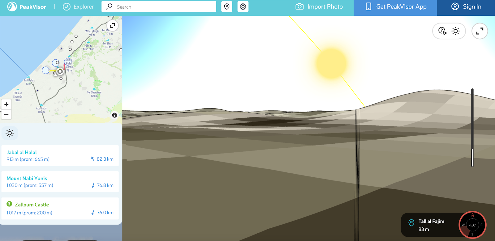
Initially developed for use by the mountaineering community, Peakvisor is a tool that has been embraced by OSINT professionals as a resource to aid in geolocation. It allows users to view the topography of an area, and in many cases match ridgelines and other features to images and video.
While Gaza is not particularly mountainous, it does have topography in areas that can be matched with the imagery available through Peakvisor. This is particularly useful given the poor quality of Google Earth imagery in the region.